Ireland 2007
(Stran je samo v angleškem jeziku. Vseeno lahko uživate v fotografijah.)
|
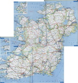
Official name: Republic of Ireland
Capital: Dublin Area: 70 273 km² Currency: Euro Population: 4 239 848 (census 2006) Official languages: Irish, English |
|
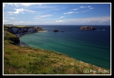
Landscape
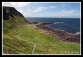
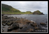
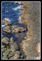
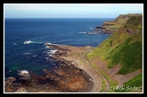
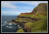
The island of Ireland extends over 84,421 km2 , of which approximately five-sixths belongs to the Republic of Ireland and the remainder constitutes Northern Ireland. It is bounded to the north and west by the Atlantic Ocean, and to the northeast by the North Channel. To the east coast is the Irish Sea, which reconnects to the ocean via the southwest with St George's Channel and the Celtic Sea. The west coast of Ireland mostly consists of cliffs, hills and low mountains. The highest point in the country is Carrauntoohil at 1,038 m which situated in the Macgillycuddy's Reeks mountain range.
|
|
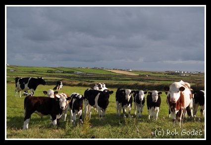
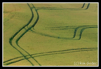
Determined by the south-westerly Atlantic winds, geographically the northwest, west and southwest of the country receives the most substantial rainfall, with Dublin being the driest region. The far-north and west of Ireland are two of the windiest regions in Europe. Due to constant rainfall Ireland is Green island. When you travel around the country green scenery follows you all the way.
One million Irish died of starvation and another 1.5 million emigrated. This set the pattern of emigration for the century to come, resulting in a constant decline up to the 1960s.
In 1922, after the Irish War of Independence and the Anglo-Irish Treaty, the larger part of Ireland seceded from the United Kingdom (UK) to become the independent Irish Free State — and after 1948 the republic, Ireland. The six north eastern counties, known as Northern Ireland, remained within the United Kingdom. The Irish Civil War followed. The history of Northern Ireland has since been dominated by sporadic sectarian conflict between (mainly Catholic) Nationalists and (mainly Protestant) Unionists. This conflict erupted into the Troubles in the late 1960s, until an uneasy peace thirty years later.
In 1922, after the Irish War of Independence and the Anglo-Irish Treaty, the larger part of Ireland seceded from the United Kingdom (UK) to become the independent Irish Free State — and after 1948 the republic, Ireland. The six north eastern counties, known as Northern Ireland, remained within the United Kingdom. The Irish Civil War followed. The history of Northern Ireland has since been dominated by sporadic sectarian conflict between (mainly Catholic) Nationalists and (mainly Protestant) Unionists. This conflict erupted into the Troubles in the late 1960s, until an uneasy peace thirty years later.
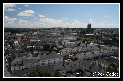    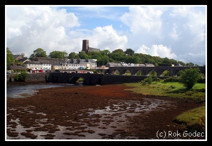   |
Towns
Most towns have grown over the past 19 centuries and some have origins which go back much further. Some towns have their roots in old Celtic monasteries, or were founded by the Normans or even the Vikings, while others grew up where medieval markets took place - or at river and seaside locations where people simply liked to live.
|
People
People are really nice, always willing to help. Sometimes it was hard because the dialect they were speaking was hard to understand, specially in Gaeltacht - mostly Gaelic speaking areas.
For us from the continent breakfast was very interesting. Irish breakfast has everything you want and desire. Vegeterians can't choose as much as others but table is full of food. There are many Bead&Breakfast facilities in Ireland. Due to the rain almost every day we chose this option few times. Breakfast was so big that we were full till late afternoon. |
|
Sources:
http://en.wikipedia.org/wiki/Ireland
http://en.wikipedia.org/wiki/History_of_Ireland
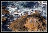
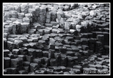
http://en.wikipedia.org/wiki/Giant%27s_Causeway
http://en.wikipedia.org/wiki/Ireland
http://en.wikipedia.org/wiki/History_of_Ireland
http://en.wikipedia.org/wiki/Giant%27s_Causeway